I’ve spent quite a lot of time in the Northern Cairngorms recently, so thought it was about time I tried somewhere else. I had hoped to head across to the west coast and the Ben Nevis area but, with the lack of snow that way, decided to travel down the A9 instead. After a warm night in the Backpackers Hotel in Pitlochry, I drove through Blair Athol to Loch Moraig where I came across three other walkers (and their two dogs) getting themselves kitted up for the day. There was no formal agreement but, to some extent, we started to walk together.
After the 2km walk in to the base of the mountain, the the long steady slog up the south-west shoulder of Carn Liath began. It was quite entertaining to watch the dogs scampering everywhere whilst their owners slowly flagged as they got higher! We passed the cloud base at about 750m and, as our world suddenly shrunk considerably, I could see slightly concerned expressions developing on faces. The dogs, on the other hand, were having a great time! Shortly before the top of Carn Liath, I left the others as they pondered how to play the rest of their day. It seems that the combination of cloud and increasing wind strength was enough to persuade them to retreat as I didn’t see them again and their car was gone by the time I finished my day.

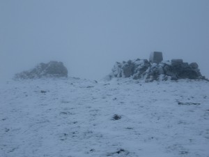
I had noticed that on my Ordnance Survey map, the top of Carn Liath was marked with two heights in the same place- 975 (976)m. This is certainly not common, so I was intrigued to discover why. As you can see in the photo, the top is actually marked in two places on the ground. The nearest is the triangulation pillar, which is normally placed at the highest point. However, it would seem that someone got it slightly wrong as the highest point is actually marked by the cairn in the background, approximately 1m higher than the triangulation pillar.
From here, it was a case of following the ridge as it works it’s was down and back up to the summit of Braigh Coire Chruinn-bhalgain. This can often be straight forward but the low cloud and the fact that the ridge meanders it’s way for the next 3km made it a bit awkward. However, some good hard snow gave me the chance to practice a bit of step cutting which was useful.
Then it was on to Carn nan Gabhar – the last and highest peak of the day, standing at 1121m. The main problem with this section of the day was the strength of the wind which had been steadily growing for a couple of hours. By now it was hitting the side of the mountain from the west. Judging wind speeds is always a bit of a guestimate, but I reckon it was in the order of 70, gusting 90 to 100mph. It was certainly strong enough to blow me uphill when I was trying to go down, and I found myself using my walking poles to brace myself in the gusts.
Looking to get out of the wind, I retraced my steps for a short while before following the Allt Bealach an Fhiodha stream down to the valley floor. During the descent, I came across quite a large area of avalanche debris that had come from a surprisingly steep section of the southern face of Braigh Coire Chruinn-bhalgain, but didn’t feel inclined to go and investigate further.


